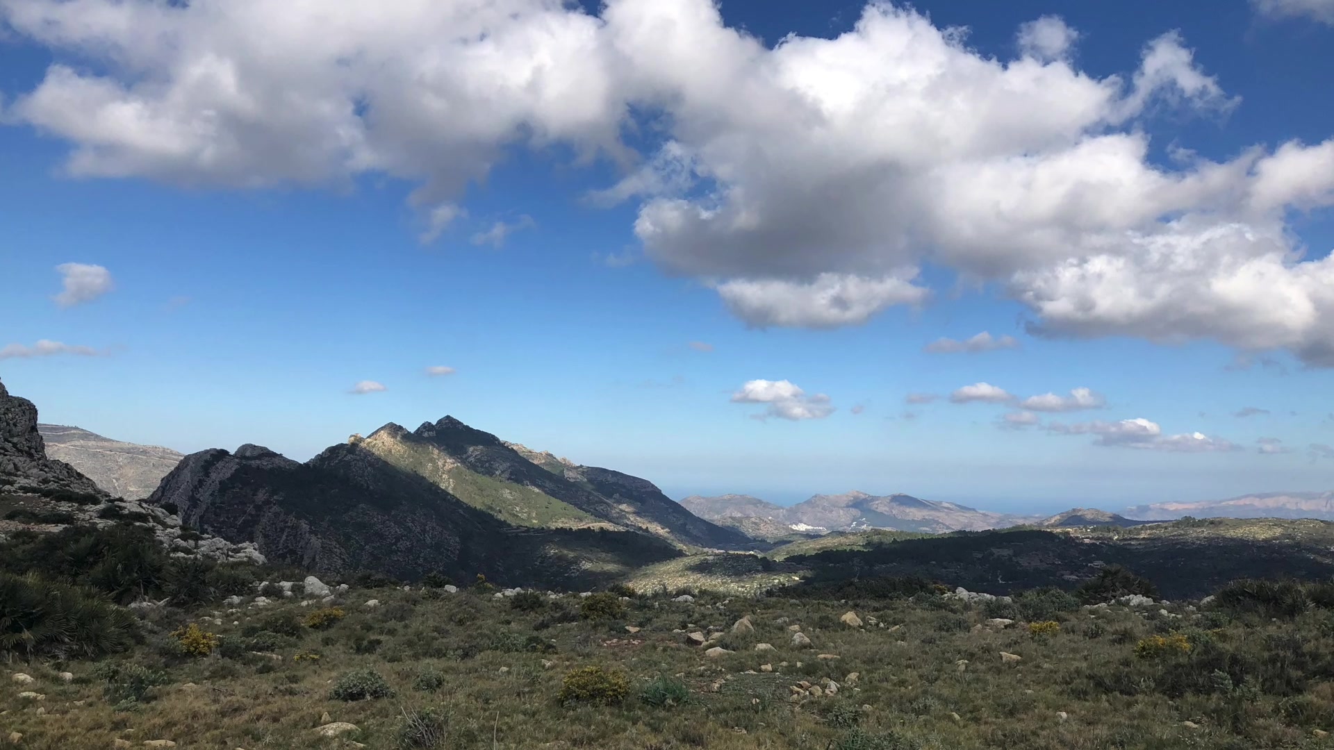
Discovering Serra of Bèrnia
IES BEATRIU FAJARDO DE MENDOZA, BENIDORM
The integration and adaptation of the mobile telephone and drones in the curriculum subject of Natural Science. Erasmus+ 2017-ES01-KA219-037967_6
Dron video of Serra Bèrnia -https://drive.google.com/drive/folders/1ryVRTc1aaRQ0ZXsQvtXbhpNLtrmT5SMd?usp=sharing

Introduction
English
In short, this is a space where unique environmental and geomorphological features are coming together with a long history of human occupation, which has resulted in
last resort to new and diverse environments of exceptional importance in the Valencian territorial context.
The protected landscape figure has been chosen to be considered suitable for the conservation of the natural, cultural and landscape values of the space, resulting from the harmonious relationship between human and the natural environment.
This space also has a European importance, in fact it is considered a LIC, ZEPA and is in the 2000 Network. A coherente European ecological network that guarantees the maintenance or, the restoration, in a state of favorable conservation, of certain types of Natural habitats and certain animal and vegetable species. The Natura 2000 network is composed of Lugares de Importancia Comunitaria (LIC) - up to its designation as Special Zones for Conservation (ZEC) -, said ZEC and the Special Protection Areas for Birds (ZEPA).
Municipalities and counties
The Sierra de Bernia is located in the dividing line between the counties of the Marina Alta and Baja, in the Valencian Country.
It stretches 11 kilometers long and extends in a perpendicular direction to the coast, from the Bolulla fault to the west to Morro de Toix to the east, where it submerges in the waters of the Mediterranean Sea. The mountains have an extension of 1,900 hectares, distributed between the municipalities of Callosa d'en Sarrià, Altea, Calp, Benissa and Xaló. The highest peak of the Bèrnia mountain range, which is used as a geodesic vertex, is located in the municipality of Xaló, measuring 1,128 m above sea level.
P.R
It is a signposted itinerary for pedestrians, formed by the connection of , paths, rattlers, tracks, etc., which avoid as much as possible the traffic on asphalted roads and with vehicle traffic. The P.R.-C.V. They have a length that ranges from a minimum of 10 km and a maximum of 50 km. In the case of exceeding 50 km, we would be talking about a GR or a long path. To signalize these paths, a series of resources and tools are used below. The paths of small tour are marked with marks of white and yellow paint, which can be made in different places: in stone, on the trunk of a tree, etc. These paint marks are represented in parallel when the direction we follow is correct, and forming a blade with the white strip on the yellow (cross of Sant Andreu) when the direction is wrong. Sometimes they appear with a strong angle that indicates a sudden change of direction. Cross-parallel signals can also appear with a white line, which indicates a variant of the trail.
Spanish
En resumen, este es un espacio donde se unen características ambientales y geomorfológicas únicas con una larga historia de ocupación humana, que ha resultado en
Último recurso a entornos nuevos y diversos de excepcional importancia en el contexto territorial valenciano.
La figura del paisaje protegido ha sido elegida para ser considerada adecuada para la conservación de los valores naturales, culturales y paisajísticos del espacio, como resultado de la relación armoniosa entre el entorno humano y el natural.
Este espacio también tiene una importancia europea, de hecho, se considera un LIC, ZEPA y está en la Red 2000. Una red ecológica europea coherente que garantiza el mantenimiento o, la restauración, en un estado de conservación favorable, de ciertos tipos de hábitats naturales y ciertas especies animales y vegetales. La red Natura 2000 está compuesta por Lugares de Importancia Comunitaria (LIC), hasta su designación como Zonas Especiales para la Conservación (ZEC), según ZEC y las Áreas de Protección Especial para Aves (ZEPA).
Municipios y comarcas
La Sierra de Bernia se encuentra en la línea divisoria entre los condados de Marina Alta y Baja, en el País Valenciano.
Se extiende a lo largo de 11 kilómetros y se extiende en dirección perpendicular a la costa, desde la falla de Bolulla al oeste hasta Morro de Toix al este, donde se sumerge en las aguas del mar Mediterráneo. Las montañas tienen una extensión de 1.900 hectáreas, distribuidas entre los municipios de Callosa d'en Sarrià, Altea, Calp, Benissa y Xaló. El pico más alto de la cordillera de Bèrnia, que se utiliza como vértice geodésico, se encuentra en el municipio de Xaló, que mide 1.128 m sobre el nivel del mar.
P.R
Es un itinerario señalizado para peatones, formado por la conexión de caminos, cascabeles, pistas, etc., que evita, en la medida de lo posible, el tráfico en carreteras asfaltadas y el tráfico de vehículos. El P.R.-C.V. Tienen una longitud que oscila entre un mínimo de 10 km y un máximo de 50 km. En el caso de superar los 50 km, estaríamos hablando de un GR o un camino largo. Para señalar estos caminos, a continuación se utilizan una serie de recursos y herramientas. Las rutas de los pequeños recorridos están marcadas con marcas de pintura blanca y amarilla, que se pueden realizar en diferentes lugares: en piedra, en el tronco de un árbol, etc. Estas marcas de pintura se representan en paralelo cuando la dirección que seguimos es correcta, y formando una cuchilla con la franja blanca en el amarillo (cruz de Sant Andreu) cuando la dirección es incorrecta. A veces aparecen con un ángulo fuerte que indica un cambio repentino de dirección. Las señales paralelas cruzadas también pueden aparecer con una línea blanca, lo que indica una variante del camino.

Geology
Spanish
Se orienta de poniente a oriente más o menos, tiene una longitud de 9km. Está constituida por calcarias cretacias en su parte mediana y oceánica en la superior, la acción tectónica tiene un relieve violento. Tiene una altura mediana de 900 metros y 1129 metros sobre el nivel del mar. Dos fallas transversales limitan la longitud: (occidente) de la sierra, el valle de Tarbena y el curso alto del Algar y el Levante por el barranco del Salat.
El nombre de la sierra antes era Verdiola por los densos pinos y la vegetación qe teniía. La sierra participa en la existencia de muchísimos hábitats y espécies de flora y fauna .
Les Serralades Bètiques o els Sistemes Bètics són el conjunt de serralades que constitueixen el segment més occidental del sistema de plegament alpí indoeuropeu. S'estenen des del sud de la península Ibèrica –del golf de Cadis– fins a Alacant i les Illes Balears. Formen part de l'Arc de Gibraltar.
Des de la seua formació, la serra ha patit diversos plegaments i falles.Des de la seua formació, la serra ha patit diversos plegaments i falles.
Las rocas, al igual que cualquier otro material, se deforman ante la acción de esfuerzos externos. Nosotros no captamos esa deformación, pero sí podemos saber cuándo una roca está deformada. Estudiando la deformación podemos saber cómo han sido los esfuerzos que la produjeron y, por tanto, reconstruir la actividad tectónica
pasada en una región. Cualquier material se puede deformar de tres maneras:
Deformación elástica: el material se deforma, pero cuando cesa el esfuerzo, la deformación desaparece (por ejemplo una goma elástica). Es, por tanto, una deformación reversible.
Deformación plástica: la deformación se mantiene aunque el esfuerzo desaparezca (como ocurre con la plastilina). La deformación es irreversible.
Deformación frágil: el material se fractura como respuesta al esfuerzo (sería el caso de un vidrio roto). Al igual que la anterior, también es irreversible..
En geologia es diu que la serra d'Oltà i el Penyal d'Ifac són olistòlits provinents del Diapir d'Altea.En geologia es diu que la serra d'Oltà i el Penyal d'Ifac són olistòlits provinents del Diapir d'Altea.
Esta siembra de grandes masas de rocas más antiguas (en ocasiones de tamaño kilométrico) sobre materiales más modernos explica la presencia de calizas eocenas sobre margas miocenas, lo que en apariencia vulnera un principio estratigráfico básico como el de la superposición de los estratos.
També veurem en el camí diferents llocs amb moltes tarteres, cantals, pedrisses o runars (canchal en castellà) formades per acumulacions de pedres menudes i soltes, resultat de procesos de meteorització, erosió, transport i sedimentació.També veurem en el camí diferents llocs amb moltes tarteres, cantals, pedrisses o runars (canchal en castellà) formades per acumulacions de pedres menudes i soltes, resultat de procesos de meteorització, erosió, transport i sedimentació.
Una serie de proceso geológicos actúan sobre las rocas de forma pasiva. Ese conjunto de procesos se denomina meteorización.
Las rocas se forman en el interior de la Tierra. Cuando ascienden a la superficie terrestre, las condiciones varían. Esto provoca transformaciones físicas o químicas en las rocas.
La meteorización es la alteración de una roca por la acción de la Atmósfera, la Hidrosfera o los seres vivos. Esta alteración se produce en el mismo lugar donde ha aflorado a la superficie, sin que se produzca transporte de materiales.
Otros procesos actúan sobre las rocas de forma activa. Estos procesos son la erosión, el transporte y la sedimentación.
Erosión
Es el desgaste de las rocas por acción del viento y el agua en sus distintas formas (ríos, mares, glaciares...). Este desgaste se produce por arrastre de partículas de las rocas, debido a estos agentes erosivos, por el choque de partículas que son transportadas en el medio contra las rocas o por el choque de unas partículas contra otras durante el transporte.
En este proceso los materiales no son transformados, como puede ocurrir en la meteorización, sólo son desgastados. Además son removidos del lugar donde estaban
Transporte
Es el arrastre de materiales erosionados por acción del viento o el agua. Los materiales son transportados atendiendo a la fuerza del agente transportador y al peso del material transportado.
El transporte puede realizarse por:
• Reptación o rodadura: es el arrastre de materiales pesados, sin levantarlos del suelo.
• Saltación: el agua o el aire elevan pequeños fragmentos que luego vuelven a caer.
• Suspensión: el aire o el agua transportan partículas muy finas que no se depositan en el suelo.
• Disolución: es el transporte de materiales que se disuelven en agua.
Sedimentación
Se produce cuando los materiales son depositados debido a la disminución de la fuerza transportadora del agente. La gravedad es la fuerza responsable de la sedimentación
L'origen de la serra de Bèrnia està unit a la formació d'un gran orogen nomenat Diapir d'Altea.Un diapiro salino es una estructura formada por el lento ascenso intrusivo de una masa plástica de evaporitas (halita y yeso) y arcillas que deforman y atraviesan las capas rocosa superpuestas.
La estructura diapírica de Altea es la más grande de Europa.Es un diapiro multifásico y complejo
cuya actividad debió iniciarse durante el Cretácico aunque su máxima actividad ascensional se produjo hace unos 18 millones de años, coincidiendo con el inicio del plegamiento del Prebético de Alicante.
Cuando el agua entra por las grietas de un macizo de roca caliza, ésta se disuelve interiormente dando
lugar a cavidades que, cuando están llenas de agua forman auténticos ríos subterráneos (sifones), y cuando se vacían dan lugar a la formación de complejos de cuevas.
Evolución del Karst
Desde que empieza a disolverse un macizo de caliza, hasta que se disuelve por completo, pasa por una serie de estados caracterizados por morfologías o paisajes típicos.
* Fase juvenil: disolución superficial. Formación de lenares. En el interior, las cavidades están llenas de agua (sifones).
* Fase de madurez: al agrandarse las cavidades, el nivel freático desciende, originándose las cavidades vadosas, estalactitas y estalagmitas. Se pueden producir hundimientos que darán lugar a la formación
de dolinas y poljés en superficie.
* Fase de senilidad: la erosión superficial deja al descubierto las cavidades interiores. Se forman paisajes tan característicos como La Ciudad Encantada o El Torcal de Antequera .
La Serra d'Aitana s'estén sobre una superfície pròxima a les deu mil hectàrees, a només uns pocs quilòmetres de la costa de la Marina. Caracteritzada per un relleu extremadament accidentat, al paisatge de la serra hi predomina aclaparadorament el roquissar, sobretot en els nivells superiors del vessant septentrional. És precisament en aquest vessant on es troben les altures principals: a més del pic que dóna nom a la serralada (Aitana, 1.558 m.), són destacables la Penya Alta (1.556 m.), la Penya Catxa (1.467 m.), la Penya del Mulero (1.308 m.) i l'Alt del Carrascar (1.208 m.). L'Aitana és el cim més alt de la província d'Alacant.
La erupción volcánica responsable de la formación de estas rocas estaría relacionada con la fracturación de Pangea que dio lugar a los continentes actuales y que, como se
muestra en el dibujo, se inició precisamente por esta región hace unos 220 Ma.
La serra compta amb 1.900 hectàrees repartides entre els termes de Callosa d'en Sarrià, Altea, Calp, Benissa i Xalpó.Es troba coronada per una esvelta cresta, amb una quota màxima de 1.128 metres, que s’estén d’oest a est des de la falla de Bolulla fins al Morro de Toix, on fineix a la mar. La Bèrnia compta amb senders que pugen des d'Altea la Vella, les Cases de Bèrnia (Xaló), o les Fonts de l'Algar (Callosa d'En Sarrià).
It is oriented from west to east more or less, has a length of 9km. It is constituted by calcarias cretacias in its median and oceanic part in the superior part, the tectonic action has a violent relief. It has a median height of 900 meters and 1129 meters above sea level. Two transverse faults limit the length: (west) of the sierra, the Tarbena valley and the upper course of the Algar and Levante by the Salat ravine.
The name of the sierra before was Verdiola because of the dense pines and the vegetation that it had. The mountain range participates in the existence of many habitats and species of flora and fauna
Les Serralades Bètiques or els Sistemes Bètics is the set of serralades that constitute the westernmost segment of the indoeuropeu alpí plegament system. S'estenen des del sud of the Ibèrica peninsula - from Cadiz golf to Alacant i les Illes Balears. Form part of l'Arc de Gibraltar.
In geology it is said that the Serra d'Oltà and the Penyal d'Ifac are olistòlits provinents of the Diapir d'Altea. In geology it is said that the Serra d'Oltà and the Penyal d'Ifac are olistòlits provinents of the Diapir d'Altea.
English
This planting of large masses of older rocks (sometimes of kilometric size) on more modern materials explains the presence of Eocene limestone on Miocene marls, which apparently violates a basic stratigraphic principle such as the superposition of the strata.
the serra has patit various plegaments i fail.
Rocks, like any other material, are deformed by the action of external forces. We do not capture that deformation, but we can know when a rock is deformed. By studying the deformation we can know how the efforts that produced it have been and, therefore, reconstruct the past tectonic activity in a region. Any material can be deformed in three ways:
Elastic deformation: the material is deformed, but when the effort ceases, the deformation disappears (due to
example an elastic band). It is, therefore, a reversible deformation.
Plastic deformation: the deformation is maintained even if the effort disappears (as it happens with the clay). The deformation is irreversible.
Fragile deformation: the material fractures in response to stress (it would be the case of a broken glass). As than the previous one, it is also irreversible ..
The origin of the serra de Bèrnia is unit to the formation of a great orogen nomenat Diapir d'Altea. A saline diapir is a structure formed by the intrusive slow rise of a plastic mass
of evaporites (halite and gypsum) and clays that deform and traverse the overlying rock layers.
When water enters the cracks of a limestone rock mass, it dissolves inside giving place in cavities that, when full of water, form authentic underground rivers (siphons), and
when they empty, they lead to the formation of cave complexes.
We will also see on the way different places with many streams, cantals, pedrises or runars (castillo in Spanish) formed by accumulations of small and loose stones, resulting from meteorization, erosion, transport and sedimentation processes. We will also see different places on the way Many cornfields, cantals, pedrises or runars (Castilian language) formed by accumulation of small and loose stones, as a result of meteorization, erosion, transport and sedimentation processes.A series of geological processes act on the rocks passively. This set of processes is called weathering.
The rocks are formed inside the Earth. When they ascend to the earth's surface, conditions vary. This causes physical or chemical transformations in the rocks.
Weathering is the alteration of a rock by the action of the Atmosphere, the Hydrosphere or living beings. This alteration occurs in the same place where it has surfaced on the surface, without transporting materials.
Other processes act on rocks actively. These processes are erosion, transport and sedimentation.
Erosion
It is the wear of the rocks by wind and water in its different forms (rivers, seas, glaciers ...). This wear is produced by dragging rock particles, due to these erosive agents, by the collision of particles that are transported in the medium against the rocks or by the collision of some particles against others during transport.
In this process the materials are not transformed, as can happen in weathering, they are only worn out. They are also removed from the place where they were
Transport
It is the dragging of materials eroded by the action of wind or water. The materials are transported according to the force of the transporting agent and the weight of the transported material.
Transportation can be done by:
• Crawling or rolling: it is the dragging of heavy materials, without lifting them off the ground.
• Saltation: water or air raise small fragments that then fall back.
• Suspension: air or water carries very fine particles that do not settle on the ground.
• Dissolution: is the transport of materials that dissolve in water.
Sedimentation
It occurs when the materials are deposited due to the decrease in the agent's transporting force. Gravity is the force responsible for sedimentation
Altea's diapiric structure is the largest in Europe. It is a multiphasic and complex diapir
whose activity should have started during the Cretaceous, although its maximum activity was
produced about 18 million years ago, coinciding with the beginning of the folding of the Alicante Prebetic.
The mountain range has 1,900 hectares spread between the towns of Callosa d'en Sarrià, Altea, Calp, Benissa and Xalpó. It is crowned by a slender crest, with a maximum quota of 1,128 meters, which extends from west to east from the failure of Bolulla to Morro de Toix, where it ends at sea. The Bèrnia has trails that go up from Altea la Vella, the Bèrnia Houses (Xaló), or the Sources of Algar (Callosa d'En Sarrià).
The volcanic eruption responsible for the formation of
these rocks would be related to the fracturing of Pangea
that gave rise to the current continents and that, as
shows in the drawing, it started precisely for this region
about 220 Ma


It is oriented from west to east more or less, has a length of 9km. It is constituted by calcarias cretacias in its median and oceanic part in the superior part, the tectonic action has a violent relief. It has a median height of 900 meters and 1129 meters above sea level. Two transverse faults limit the length: (west) of the sierra, the Tarbena valley and the upper course of the Algar and Levante by the Salat ravine.
The name of the sierra before was Verdiola because of the dense pines and the vegetation that it had. The mountain range participates in the existence of many habitats and species of flora and fauna the serra has patit various plegaments i fail.
Rocks, like any other material, are deformed by the action of external forces. We do not capture that deformation, but we can know when a rock is deformed. By studying the deformation we can know how the efforts that produced it have been and, therefore, reconstruct the past tectonic activity in a region. Any material can be deformed in three ways:
Elastic deformation: the material is deformed, but when the effort ceases, the deformation disappears (due to example an elastic band). It is, therefore, a reversible deformation.
Plastic deformation: the deformation is maintained even if the effort disappears (as it happens with the clay). The deformation is irreversible.
Fragile deformation: the material fractures in response to stress (it would be the case of a broken glass). Asthan the previous one, it is also irreversible ..
The origin of the serra de Bèrnia is unit to the formation of a great orogen nomenat Diapir d'Altea. A saline diapir is a structure formed by the intrusive slow rise of a plastic mass
of evaporites (halite and gypsum) and clays that deform and traverse the overlying rock layers.
Altea's diapiric structure is the largest in Europe. It is a multiphasic and complex diapir
whose activity should have started during the Cretaceous, although its maximum activity was
produced about 18 million years ago, coinciding with the beginning of the folding of the Alicante Prebetic.
When water enters the cracks of a limestone rock mass, it dissolves inside giving place in cavities that, when full of water, form authentic underground rivers (siphons), and
when they empty, they lead to the formation of cave complexes.
The mountain range has 1,900 hectares spread between the towns of Callosa d'en Sarrià, Altea, Calp, Benissa and Xalpó. It is crowned by a slender crest, with a maximum quota of 1,128 meters, which extends from west to east from the failure of Bolulla to Morro de Toix, where it ends at sea. The Bèrnia has trails that go up from Altea la Vella, the Bèrnia Houses (Xaló), or the Sources of Algar (Callosa d'En Sarrià).
In geology it is said that the Serra d'Oltà and the Penyal d'Ifac are olistòlits provinents of the Diapir d'Altea. In geology it is said that the Serra d'Oltà and the Penyal d'Ifac are olistòlits provinents of the Diapir d'Altea.
This planting of large masses of older rocks (sometimes of kilometric size) on more modern materials explains the presence of Eocene limestone on Miocene marls, which apparently violates a basic stratigraphic principle such as the superposition of the strata.
Les Serralades Bètiques or els Sistemes Bètics is the set of serralades that constitute the westernmost segment of the indoeuropeu alpí plegament system. S'estenen des del sud of the Ibèrica peninsula - from Cadiz golf to Alacant i les Illes Balears. Form part of l'Arc de Gibraltar.
We will also see on the way different places with many streams, cantals, pedrises or runars (castillo in Spanish) formed by accumulations of small and loose stones, resulting from meteorization, erosion, transport and sedimentation processes. We will also see different places on the way Many cornfields, cantals, pedrises or runars (Castilian language) formed by accumulation of small and loose stones, as a result of meteorization, erosion, transport and sedimentation processes.A series of geological processes act on the rocks passively. This set of processes is called weathering.
The rocks are formed inside the Earth. When they ascend to the earth's surface, conditions vary. This causes physical or chemical transformations in the rocks.
Weathering is the alteration of a rock by the action of the Atmosphere, the Hydrosphere or living beings. This alteration occurs in the same place where it has surfaced on the surface, without transporting materials.
Other processes act on rocks actively. These processes are erosion, transport and sedimentation.
Erosion
It is the wear of the rocks by wind and water in its different forms (rivers, seas, glaciers ...). This wear is produced by dragging rock particles, due to these erosive agents, by the collision of particles that are transported in the medium against the rocks or by the collision of some particles against others during transport.
In this process the materials are not transformed, as can happen in weathering, they are only worn out. They are also removed from the place where they were
Transport
It is the dragging of materials eroded by the action of wind or water. The materials are transported according to the force of the transporting agent and the weight of the transported material.
Transportation can be done by:
• Crawling or rolling: it is the dragging of heavy materials, without lifting them off the ground.
• Saltation: water or air raise small fragments that then fall back.
• Suspension: air or water carries very fine particles that do not settle on the ground.
• Dissolution: is the transport of materials that dissolve in water.
Sedimentation
It occurs when the materials are deposited due to the decrease in the agent's transporting force. Gravity is the force responsible for sedimentation
Evolution of the Karst
Since a limestone mass begins to dissolve, until it dissolves completely, it passes through a series of states characterized by morphologies or typical landscapes.
* Youth phase: surface dissolution. Training of lenares. Inside, the cavities are full of
water (siphons).
* Maturity phase: when the cavities are enlarged, the phreatic level decreases, originating the cavities vadosas, stalactites and stalagmites. Subsidence may occur that will lead to the formation of dolines and poljes on surface.
* Senility phase: surface erosion reveals the interior cavities. Landscapes are formed
as characteristic as The Enchanted City or El Torcal de Antequera.
La Serra d'Aitana extends over an area close to ten thousand hectares, only a few kilometers from the coast of La Marina. Characterized by an extremely rugged relief, in the landscape of the Sierra, the rocks are predominantly overwhelming, especially at the upper levels of the northern slope. It is precisely on this point where the main heights are: besides the peak that gives its name to the mountain range (Aitana, 1,558 m.), The Penya Alta (1,556 m.), Penya Catxa (1,467 m.), the Penya del Mulero (1,308 m) and the Alt del Carrascar (1,208 m.). The Aitana is the highest peak in the province of Alicante.
The volcanic eruption responsible for the formation of these rocks would be related to the fracturing of Pangea that gave rise to the current continents and that, as shows in the drawing, it started precisely for this region about 220 Ma
Mediterranean forest

L'ecosistema mediterrani està determinat pel seu clima. Característiques de clima mediterrani
La vegetación típica es esclerófila y xerófila, ya que tiene que soportar la aridez estival. La especie dominante es la encina. El sotobosque es leñoso, espinoso y aromático, con especies como el lentisco, el aladierno, numerosas lianas como la zarzaparrilla y, en los claros, las jaras, el romero y el tomillo
El fuego juega un papel importante en la dinámica de estos bosques y, por ello, las especies que lo componen han desarrollado numerosos mecanismos para adaptarse a los incendios.

The Mediterranean ecosystem is determined by its climate. of Mediterranean climate
The typical vegetation is sclerophyllous and xerophilous, since it has to withstand summer aridity. The dominant species is oak. The undergrowth is woody, thorny and aromatic, with species such as the mastic, the aladierno, numerous lianas such as the sarsaparilla and, in the clearings, the cistus, the rosemary and the thyme
Fire plays an important role in the dynamics of these forests and, therefore, the species that comprise it have developed numerous mechanisms to adapt to fire.
The principal adaptations of the mediterranean vegetation
The Mediterranean forests are mostly evergreen, although there are also marcescent species, that is, they have deciduous leaves that remain on the tree until the following spring, to protect the buds of the new leaves.
The Mediterranean country has been inhabited since ancient times, and human intervention in biocenosis has been decisive in shaping the landscape and the environment. The forest is degraded in garrigue, dominated by the Kermes oak, maquis and Mediterranean steppe, depending on the importance of the degradation. In the Iberian Peninsula there is a type of clearing of the Mediterranean forest known as dehesa.
The Mediterranean forest ecosystem is very sensitive to desertification if its vegetation cover is destroyed. The torrential rains drag the soil with ease and erode very quickly.

As one of our most popular services, these appointments tend to fill up fast. No matter what type of travel you need to plan, rest assured that we will provide all the resources and guidance you need for the perfect trip.

Productivity.
The Posidonia meadows are the main primary producer of the Mediterranean Sea.
• Generate between 4 and 20 liters of oxygen per day for each square meter constituting one
of the most important sources of oxygenation
of this sea. Part of this oxygen is di-
fused to the Earth's atmosphere during
periods of maximum productivity.
• Produce an average of 38 tons of bio-
mass in dry weight per hectare. These levels
The products of production are the largest of all
Mediterranean (Boudouresque and Meinesz,
1982). 30% of the primary production of
the prairies, in the form of dead leaves, is
dragged to deeper areas. These leaves to decompose for such nutrients the lower floors of the trophic chain, by bacteria, protozoa and fungi and also predators, like fish, in the higher links (Augier, 1986). Habitat.
The meadows of Posidonia oceanica
constitute one of the richest and most diverse habitats of the Mediterranean Sea.
• It is estimated that more than 400 vegetative species animals and 1000 animals live in the
of Posidonia. A large number of
these species live exclusively in the
dimentos and an elevation of the bottom, thanks to the materials and the remains of dead rhizomes cough. The rhizomes of Posidonia oceanica they have the ability to grow vertically, thanks to which Meadows are not buried under the sediments. Only the top layer of rhizome, 30 centimeters approximately, it remains alive. This growth and vertical elevation causes the grasslands to form vertical structures of rhizomes and sediments denomined terraces. These submerged structures play a important role in the dynamics and hydrodynamics of the
coast:
• On the one hand, the network of rhizomes and roots stabilize the fund by consolidating the sedi-
ment that is retained and precipitated by leaves in continuous movement. Thanks to this
process is formed a soil rich in organic matter
due to the decomposition of the re-
prairie cough.
• In areas of low hydrodynamism this elevation
The prairie comes to create a structure
Longitudinal parallel to the coast
reef-barrier , close to the surface. Is
structure is between the sea and the cos-
taining the effect of the waves on the
yas. In favorable environmental conditions,
elevation of these barriers is estimated at 1
cm every year (see figure 4).
• The accumulation of dry leaves on the beaches,called uplift, attenuates the effect of
on the sand, protecting it and avoiding
regression of the coastline. It is common to see in the Mediterranean beaches accumulations of leaves dead of posidonia and remains of rhizomes. Adequate more, due to the action of the waves, the curls but they break forming some characteristics named balls sea balls, What are they deposited on the beaches (see figure 5).
• In shallow grasslands the leaves exert a braking action similar to barrier reefs.
18 meters of coastline.
• The degradation or disappearance of grasslands of Posidonia oceanica in certain areas
has produced an alteration in the processes
of erosion and instability of seabeds
us, burying or erosion of beaches and the
accumulation of sediments around
ports and breakwaters.
l
Los bosques mediterráneos son en su mayor parte perennifolios, aunque también hay especies marcescentes, es decir, que presentan hojas caducas pero que permanecen en el árbol hasta la siguiente primavera, para proteger las yemas de las nuevas hojas.
El país mediterráneo ha estado poblado desde muy antiguamente, y la intervención humana en la biocenosis ha sido decisiva para formar el paisaje y el medio. El bosque se degrada en garriga, dominada por la coscoja, maquia y estepa mediterránea, dependiendo de la importancia de la degradación. En la península Ibérica existe un tipo de aclarado del bosque mediterráneo conocido como dehesa.
El ecosistema de bosque mediterráneo es muy sensible a la desertificación si se destruye su cubierta vegetal. Las lluvias torrenciales arrastran el suelo con facilidad y se erosiona con gran rapidez.
English
The principal adaptations of the mediterranean vegetationThe Mediterranean forests are mostly evergreen, although there are also marcescent species, that is, they have deciduous leaves that remain on the tree until the following spring, to protect the buds of the new leaves.The Mediterranean country has been inhabited since ancient times, and human intervention in biocenosis has been decisive in shaping the landscape and the environment. The forest is degraded in garrigue, dominated by the Kermes oak, maquis and Mediterranean steppe, depending on the importance of the degradation. In the Iberian Peninsula there is a type of clearing of the Mediterranean forest known as dehesa.The Mediterranean forest ecosystem is very sensitive to desertification if its vegetation cover is destroyed. The torrential rains drag the soil with ease and erode very quickly.
History
English
The entrance of the Bèrnia hole has a karstic origin but the human being excavated the rest of the gallery until it reached the other side with a fundamental purpose. This hole was also known by another name related to livestock. Bèrnia Hole, a short natural corridor of about 21 meters that connects the two slopes of the mountain range, known as the count of goats.
You will find on the road the poster of the cave paintings of the Ermita del Vicari. They belong to the Neolithic period, more than 5,000 years ago when its settlers were engaged in agriculture and livestock.
When you leave Fort you go to the neck of Xaló, a place known as the passage of the bandits. They were there to hide, because it was difficult to access and also because it was the passage of the Marina Baja to the Marina Alta, for that reason they fought the merchandise carriages. Pinet was Josep Martorell i Llorca, Mascarat was a very rare man who lived in those places until 1610.
Fort of Bèrnia it is a construction designed by Felipe II (year 1562), whose function was the defense of the coastal towns, and despite dominating much of the coast, was far away and prevented a rapid response against an attack, that is why Felipe III ordered to demolish it to avoid its occupation.It is located about 840 meters above sea level in the Sierra de Bèrnia ridge.
Forestry, livestock and snow trade were very important in the economy of the interior villages. Going down to the houses of Bèrnia we will pass through some snow wells. Snow wells are dry wells of varying diameter where the snow was kept and kept for use in summer.
Spanish
La entrada del agujero de Bèrnia tiene un origen kárstico, pero el ser humano excavó el resto de la galería hasta que llegó al otro lado con un propósito fundamental. Este agujero también era conocido por otro nombre relacionado con el ganado. Bèrnia Hole, un corto corredor natural de aproximadamente 21 metros que conecta las dos laderas de la cordillera, conocido como el conteo de cabras.
Encontrará en la carretera el cartel de las pinturas rupestres de la Ermita del Vicari. Pertenecen al período neolítico, hace más de 5.000 años, cuando sus colonos se dedicaban a la agricultura y la ganadería.
Cuando sales de Fort vas al cuello de Xaló, lugar conocido como el paso de los bandidos. Estaban allí para esconderse, porque era de difícil acceso y también porque era el paso de la Marina Baja a la Marina Alta, por esa razón lucharon contra los vagones de mercancías. Pinet fue Josep Martorell i Llorca, Mascarat fue un hombre muy raro que vivió en esos lugares hasta 1610.
Fuerte de Bèrnia es una construcción diseñada por Felipe II (año 1562), cuya función era la defensa de los pueblos costeros, y pese a dominar gran parte de la costa, estaba muy lejos y evitó una respuesta rápida contra un ataque, por eso Felipe III ordenó demolerlo para evitar su ocupación. Está ubicado a unos 840 metros sobre el nivel del mar en la cordillera de la Sierra de Bèrnia.
La silvicultura, el ganado y el comercio de nieve fueron muy importantes en la economía de las aldeas del interior. Bajando a las casas de Bèrnia pasaremos por unos pozos de nieve. Los pozos de nieve son pozos secos de diámetros variables donde la nieve se guardó y se mantuvo para el uso en verano.


Environmental impacts
Spanish
Los impactos ambientales de los campos de golf son muy diversos: consumo de territorio, urbanización del medio rural y natural, pérdida de conectores biológicos entre espacios naturales, contaminación de acuíferos, desfiguración del paisaje, presión humana por incremento del tráfico, ruido, contaminación lumínica nocturna, etcEstá comprobado que los ecosistemas vegetales más próximos a la madurez ecológica arden con más dificultad que otras formaciones vegetales y después del incendio la regeneración de la cubierta original, con igual composición y estructura, es más rápida.
La destrucción de los ecosistemas y las cadenas tróficas dificulta la regeneración de la fauna preexistente antes del incendio,fundamentalmente por la ausencia de estrato vegetal que aporte alimento y por la condiciones extremas que presenta el suelo.El incendio incrementa la impermeabilidad del suelo, sobre todo de aquellos más orgánicos, ya que de por sí muy impermeables cuando están excesivamente secos.Tras un incendio, estas especies son capaces de rebrotar rápido, porque aunque parezca que están muertas, realmente no lo están. Además se aprovechan de que tienen un extenso sistema radicular al servicio de los pequeños nuevos brotes. Así que suelen ser especies que se recuperan rápidamente, rebrotando con bastante vigorosida
A : Adultos.
H : Huevos.
L : Larvas u orugas (Pueden diferenciarse fases larvarias mediante el uso de números: 1L, 2L, 3L,...nL).
P : Pupas o crisálidas.
D : Diapausa.
English
The environmental impacts of golf courses are very diverse: consumption of territory, urbanization of the rural and natural environment, loss of biological connectors between natural spaces, contamination of aquifers, disfigurement of the landscape, human pressure due to increased traffic, noise, light pollution nocturnal, etc. It is proven that the plant ecosystems closest to the ecological maturity burn with more difficulty than other vegetation and after the fire the regeneration of the original cover, with the same composition and structure, is faster. The destruction of ecosystems and trophic chains hinders the regeneration of pre-existing fauna before the fire, mainly due to the absence of plant strata that provide food and the extreme conditions of the soil. The fire increases the impermeability of the soil, especially of those that are more organic, because they are very impermeable when they are excessively dry. After a fire, these species are capable of sprouting fast, because even if they look like they are dead, they really are not. They also take advantage of the fact that they have an extensive root system at the service of small new shoots. So they are usually species that recover quickly, regrowing with enough vigorosida


Health
Beneficios
Spanish
Mejora tu autoestima :se cree que pasear cerca del agua mejora nuestra auestima .
Aclara tu mente:las personas pasean en la naturaleza muestran menores niveles de melancolía o pensamientos obsesivos.
Te hace más creativo: en un estudio de 2012 que tras 4 días de paseos por la naturaleza, sin acceso a la tecnología, los participantes puntuaron un 50% más alto en un test conocido como RAT (Remote Associates Test). Se trata de una forma sencilla de medir el potencial creativo en las personas.
Potencia tu concentración:por ejemplo una persona con TDAH le cuesta mucho concentrarse o relacionarse con el resto.Sin embargo se llegó a la conclusión de que si una persona con TDAH hace senderismo sus síntomas se reducen
Ayuda a curar enfermedades graves: pusieron a prueba a hombres y mujeres que sufrieron cáncer de mama y próstata y vieron que hacer senderismo mejora la capacidad antioxidativa .
English
Improve your self-esteem: it is believed that walking near water improves our self-esteem.
Strengthen your concentration: for example, a person with ADHD has a hard time concentrating or relating to the rest. However, it was concluded that if a person with ADHD hiking their symptoms are reduced
It makes you more creative: in a 2012 study that after 4 days of nature walks, without access to technology, participants scored 50% higher on a test known as RAT (Remote Associates Test). It is a simple way to measure the creative potential in people.
Clarify your mind: people stroll in nature show lower levels of melancholy or obsessive thoughts.
It helps to cure serious diseases: they tested men and women who suffered breast and prostate cancer and saw that hiking improves the antioxidant capacity.


Erasmus +


All Videos